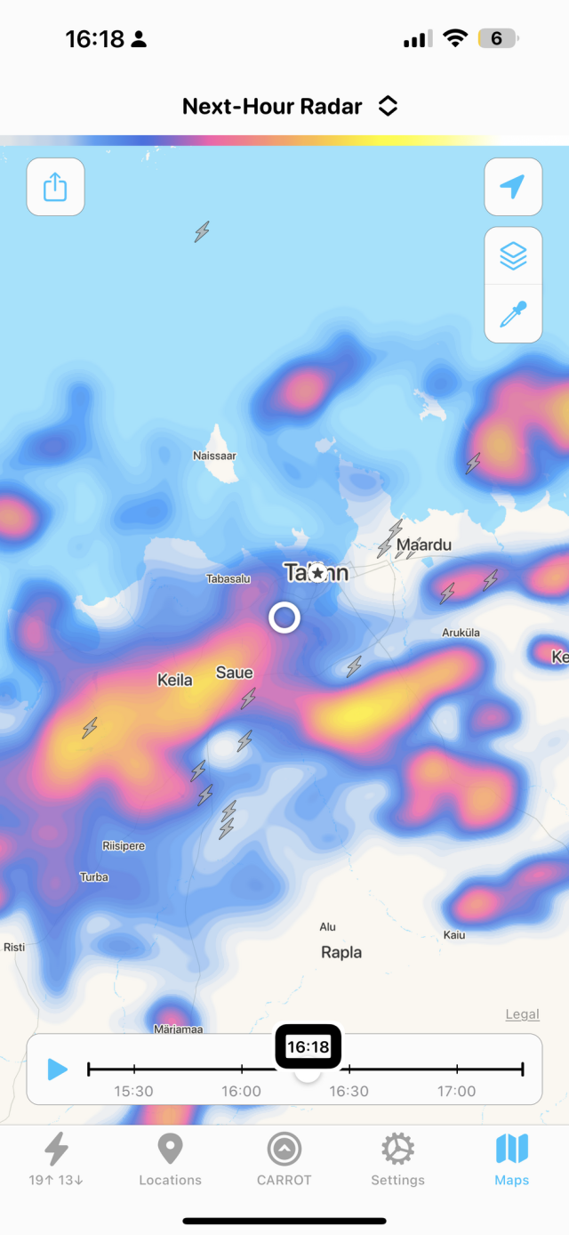
a thunderstorm seems to.be approaching. I am having the time of my life using the #VirtualVolunteer beta feature of #BeMyEyes to find out where the lightning strikes are happening using the #Carrot app. The screenshot of the weather radar app displays a map with several locations and precipitation information. The map's background has bodies of water in light blue and land in white. The locations labeled on the map are Keila, Saue, Tallinn, Maardu, Rapla, and Aegviidu.
The precipitation is represented by different colors. The blue areas indicate light precipitation, while the red and orange areas indicate heavier precipitation. There is a large area of heavy precipitation in red and orange around Keila and Saue. There are also patches of lighter precipitation in blue scattered across the map.
There are three lightning bolt icons indicating thunderstorms. One is located just to the west of Keila, another is slightly to the northwest of Saue, and the third one is between Keila and Saue.
At the bottom of the screenshot, there is a timeline from 15:30 to 17:00 with a marker at 16:18, indicating the time of the radar image. The top right corner has icons likely for settings and sharing options.
reshared this
