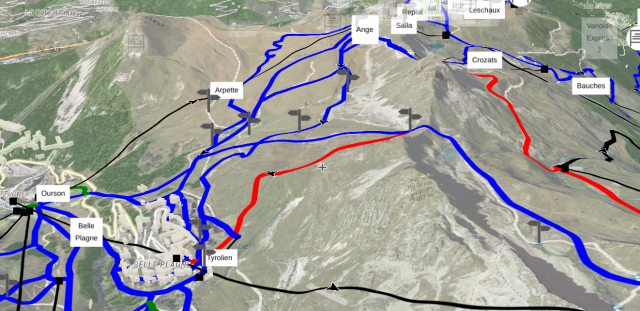
A new thematic #map arrived: mapcomplete.org/ski
It features an interactive display of:
- #ski pistes
- #aerialways
- 3D-visualisation of the terrain
- various useful POI, such as #guideposts, information boards, #restaurants mountain #rescue stations, ...
All data is of course based on #OpenStreetMap (with the addition of height data and aerial imagery of course)
This might or might not be created because @pietervdvn went #skiing last week ;)

Thibaultmol 🌈
in reply to MapComplete • • •For those who want to look at the specific location in the screenshot:
mapcomplete.org/ski?z=14.9&lat…
(then if you're on desktop, hold down CRTL and draw with your mouse to rotate.)
Ski pistes and aerialways
mapcomplete.orgjeancf
in reply to MapComplete • • •MapComplete
in reply to jeancf • • •TrailStash
in reply to MapComplete • • •RGB terrain artifacts in Firefox with Strict Tracking Protection · Issue #3537 · maplibre/maplibre-gl-js
GitHub