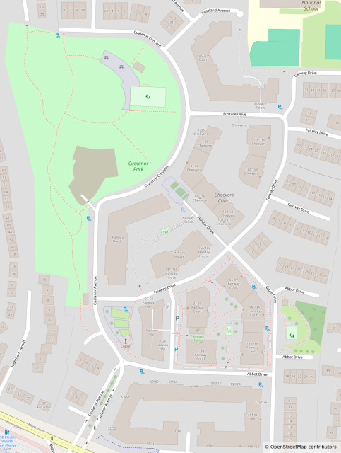
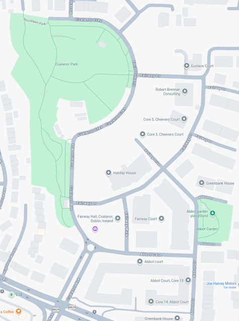
I saw @richlv post the other day about #GoogleMaps vs #OpenStreetMap and needed to share this as well.
I first noticed this difference a few months back when my driving instructor couldn't find the location that I sent him (because Google Maps doesn't show it at all). Only after I added "Fairway Walk" (see Google Screenshot for the name/location) as a named road to OSM, did it get added to Google Maps. There are still apartments missing from the Google Maps though.


Pietervdvn
in reply to governorkeagan • • •From an urbanism perspective, it makes no sense that the streets Highton Woods, Woodlawn park are not connected to the park.
Also: why is there no connection for cyclists/pedestrians between Hightorn Park and Mounttown park? And to the park too? Would make the area so much more cyclist/pedestrian friendly
governorkeagan
in reply to Pietervdvn • • •my best guess would be because this was a golf course (the park) that was converted to a housing estate.
EDIT:
You can see what I mean if you look at the Esri World Imagery from 2016 or earlier.
livingatlas.arcgis.com/wayback…
World Imagery Wayback
livingatlas.arcgis.com