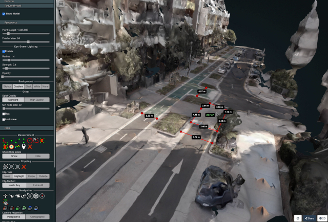
I wrote a technical guide showing how you can create your own orthorectified (aka satellite view/bird mode) imagery, point clouds and 3D models of streets with nothing but a 360 degree camera mounted on bicycle helmet, and the open source photogrammetry software OpenDroneMap.
Why might you want to do this? With your own up-to-date, highly detailed point clouds and imagery you could:
- quantify and communicate inefficient road space allocation
- record necessary infrastructure repairs
- take measurements such as lane and cycleway widths
- measure footpath obstructions in 3D and rate pedestrian amenity
- map kerb features on OpenStreetMap
- survey street parking using the new OSM spec: wiki.openstreetmap.org/wiki/St…
- 3D print a model of your home street!
jakecoppinger.com/2022/12/crea…
#openstreetmap #opendronemap #maps #photogrammetry #curb #kerb #parking #cycling #urbanism #mapping
Creating aerial imagery with a bike helmet camera (GoPro) and OpenDroneMap - Jake Coppinger
This technical guide details how you can create your own orthorectified (aka satellite view/bird mode) imagery, point clouds and 3D models of streets with nothing but a 360 degree camera mounted on bicycle helmet, and the open source photogrammetry s…https://jakecoppinger.com/author/jakcop_t1chd5/#author (Jake Coppinger)

