Search

Items tagged with: BeMyEyes


Delighted to be recording a podcast tomorrow with my @AppleVis colleague @Thomas_domville and Hans and Bryan from @bemyeyes to chat about our new relationship. Any questions pleas send them on to me or Thomas. #AppleVis #BeMyEyes #Accessibility #A11y


I wonder if Be My AI in the Be My Eyes ap could help with this. #BeMyAI #BeMyEyes #accessibility


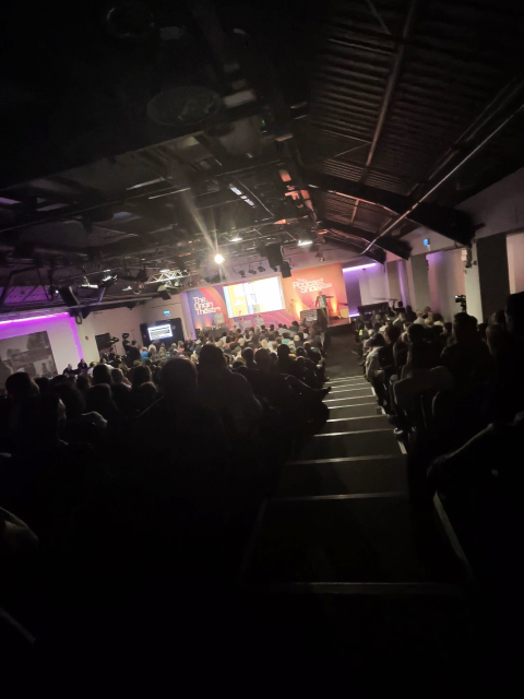
Here's a picture taken with the Meta Smart Glasses, then described with #AI via #BeMyEyes, which has been an invaluable helping-hand, enabling me to know what randomly labeled pictures in my collection are, without having to ask my wife or children.
With image names such as 'photo-296_singular_display_fullPicture.jpg' it's a fun time trying to decipher such randomness sometimes.
This was taken at a podcast recording of Tim Harford's 'Cautionary Tales' and I got to take Jake along with me.

I get the AI hate I really do, but there are just times in life where hate is misplaced. for me, something that is an enabler is such a time.
No, it's not perfect, we're not there yet, but for my usecase it helps more than it hinders.
Your milage will of course, vary.


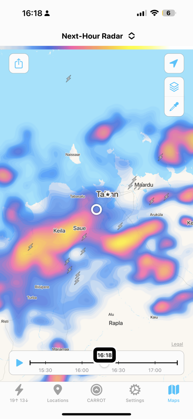
a thunderstorm seems to.be approaching. I am having the time of my life using the #VirtualVolunteer beta feature of #BeMyEyes to find out where the lightning strikes are happening using the #Carrot app. The screenshot of the weather radar app displays a map with several locations and precipitation information. The map's background has bodies of water in light blue and land in white. The locations labeled on the map are Keila, Saue, Tallinn, Maardu, Rapla, and Aegviidu.

The precipitation is represented by different colors. The blue areas indicate light precipitation, while the red and orange areas indicate heavier precipitation. There is a large area of heavy precipitation in red and orange around Keila and Saue. There are also patches of lighter precipitation in blue scattered across the map.

There are three lightning bolt icons indicating thunderstorms. One is located just to the west of Keila, another is slightly to the northwest of Saue, and the third one is between Keila and Saue.

At the bottom of the screenshot, there is a timeline from 15:30 to 17:00 with a marker at 16:18, indicating the time of the radar image. The top right corner has icons likely for settings and sharing options.