Murals can also be added and uploaded to #OpenStreetMap with mapcomplete.org/artwork
Those pictures might be posted by @mapcomplete_edits
Murals can also be added and uploaded to #OpenStreetMap with mapcomplete.org/artwork
Those pictures might be posted by @mapcomplete_edits
Looking for vegan places and not a fan of proprietary datasets? #MapComplete has several themes to find (and edit) vegan places, based on #OpenStreetMap data!
The “restaurants and fast food” theme will show most places you might be interested in. If you love fries (like I do), “fries shops” will be helpful for you. And in the “gluten free” and “lactose free” themes, you can filter for vegan places too!
You can also easily edit these places with MapComplete, for example to add details or update incorrect or outdated information. Your changes will be uploaded to OpenStreetMap, which is freely reusable data!

MapComplete is a platform to visualize OpenStreetMap on a specific topic and to easily contribute data back to it.mapcomplete.org
I moved nearly 40K pictures (which were linked from #OpenStreetMap and created with @MapComplete from imgur to @panoramax
You can read more about the proces
openstreetmap.org/user/Pieter%…
Thanks to @thibaultmol for hosting the server

As you might know, Im the main developer of MapComplete. For those who dont know, MapComplete is an OSM-viewer and editor, where contributors can easily answer questions, add new points and upload pictures from a POI from a cozy website.OpenStreetMap
nice service by @jaller94: find missing #stolpersteine on #osm in your berlin kiez. simply load the gpx file into your favourite osm app (e.g. osmand) and add missing stolpersteine to #openstreetmap.
gpx-files: osm-check.chrpaul.de/report/st…
sourcecode: gitlab.com/jaller94/osm-check-…
Hey würde jemand Lust verspüren sich beim Betrieb eines deutschen #panoramax Servers einzubringen? Streetview Photos unter CC und für OSM 
community.openstreetmap.org/t/…
#selfhosting #openstreetmap #fossgis #gistribe #datenschutz #photografie

Wenn es um das Problem des Hostens der Bilder geht könnte man vielleicht gucken, dass man die Bilder einfach auf Wikimedia Commons speichert und Panoramax nur als Viewer für die auf den Wikimedia Servern liegenden Fotos nutzt.OpenStreetMap Community Forum
We moved about 10K images already, about 2.8% of all 'image'-tags in the #OpenStreetMap-database. All those moved images are made in Flanders.
There are 19K images hosted on Imgur, of which the vast majority (probably 18K) are made with MapComplete and will be moved soon.
If your app supports the image tag, it might be neat to start supporting panoramax too. See the wiki for details. OpenAEDMap just implemented it (see github.com/openstreetmap-polsk…, might not be live ATM)

❤️ Backend powering OpenAEDMap.org — an OpenStreetMap's life-saving AED map - Add support for panoramax · openstreetmap-polska/openaedmap-backend@c035154GitHub
Op vrijdag 22 november (13u30) en zaterdag 23 november (11u) organiseer ik een wandeling vanuit de Krook in #Gent waar we met #OpenStreetMap en @MapComplete bewakingscamera's in kaart gaan brengen.
Na een korte uitleg gaat iedereen een eigen kant op, op zoek naar camera's.
Dit past binnen mutationfest.be/program
(Of je kan ook meer info vinden op de meetup-pagina: meetup.com/openstreetmap-belgi…)
#privacy #bewakingscameras #surveillance

Ontdek de rode draad die vier unieke locaties aan Gent Zuid verbindt. Laat je drie dagen verwonderen door een intensief programma.Mutation
AWESOME new @kagihq update:
For ex: I want to look at the #OpenStreetMap wiki page for (power) sockets.
Previously you could do search like this:
socket !osmwiki
this would bring you to wiki.openstreetmap.org/wiki/Sp…
But if I know that the chance of the right page being the first result on #Kagi is high, I can just do:
socket @osmwiki !
then I land on: wiki.openstreetmap.org/wiki/Ke…:*
! is basically the Kagi equivalent of that google "i'm feeling lucky" feature from back in the day

On this map, publicly accessible drinking water spots are shown and can be easily addedmapcomplete.org
🚶♂️🗺️ Doe mee aan de LiLi-app mapathon in Brugge!
Op 29 november van 18:00-22:00 in het Hof van Watervliet helpen we OpenStreetMap België met het toegankelijker maken van de stad voor blinden en slechtzienden. Samen vullen we ontbrekende infrastructuur aan die de Lili-app gebruikt om de veiligste routes te bepalen.
Meer info: amai.vlaanderen/projecten/proj…
📍 Locatie: Hof van Watervliet, Brugge
⏰ Tijd: 18:00 - 22:00
💻 Meenemen: Laptop (muis handig)
osmcal.org/event/3228/

OpenStreetMap België organiseert een mapathon in Brugge in het kader van onze deelname aan het “[Lili-app project](https://amai.vlaanderen/projecten/project3-lili)”.OpenStreetMap Calendar


*This* is the type of game I was talking about. This game uses #OpenStreetMap so that you can play "in" your local town.
store.steampowered.com/app/136…

Build your own bus depot from scratch and create your personal bus routes in City Bus Manager. Play in your own hometown or any famous city in the world with real map data.store.steampowered.com
For our (small) master dissertation about #education (but mostly because we are interested), we are doing research about using #OpenStreetMap within #secondary education (roughly 12 - 18 years old, but with a focus on 16 - 18 years old).
The long-term goal is to create a usable #lesson where pupils go out and map using a data collection app. If you have any experience with this, would you be so kind to spend 10 minutes of your time to fill out the survey?
Guess when #MapComplete started uploading pictures to our @panoramax -instance and started introducing `panoramax`-tags to the #OpenStreetMap-database...
There are 614 pictures in our instance for now.
If you want to see the graph for yourself, it is here: taghistory.raifer.tech/?#***/p…

I sometimes get the question why I'm not allowing anonymous contributions to #OpenStreetMap via #MapComplete .
I've gotten the question again today, so I decided to write down why I'm not adding nor planning
this: github.com/pietervdvn/MapCompl…
Voor de duidelijkheid: #MapComplete werkt op/met dezelfde database waar heel veel apps op werken: #openstreetmap.org (de Wikipedia van kaarten). Wat je toevoegt komt dus uiteindelijk bij iedereen terecht. Doen dus!
Tři postřehy z povodní
Letošní velké povodně se naší rodině vyhnuly. Přesto jsem jejich průběh sledoval, protože v zasažených oblastech jsem měl vzdálenější rodinu, kolegy, známé. Jak už to u takových tragických událostí bývá, vyvolaly celou řadu diskusí: o schopnosti krajiny zadržovat vodu, budování přehrad, polderů atd. Mě ale pohledem ajťáka zaujaly tři věci.
#opendata #OpenStreetMap #povodně #povodne2024 #sociálníSítě
blog.eischmann.cz/2024/09/18/t…

I've recently taken to adding a direction tag to benches in #OpenStreetMap. My convention is that the tag value corresponds to the direction of view.
Delighted to find that @vespucci_editor now shows (single) direction values, but wished I'd known about the whizzy direction tag gadget which uses the phone's compass yesterday. (It's a bit too clever if adding the values in retrospect.)


#Glocken online - Schönes Projekt!
Leider fehlt mir die Freiheit, es uneingeschränkt zu empfehlen, solange keine trackingfreien Dienste, wenigstens alternativ wie z.B. #OpenStreetMap oder #PeerTube, verwendet werden.
createsoundscape.de/
Schade, dass es auf Nachfrage so gar keine Reaktion gibt.
#RespektDerDigitalenPrivatsphäre, besonders bei Projekten mit Jugendlichen.
@fabianstadler Everything is #OpenStreetMap data, so someone added it. You can see the history of an object if you log in and press the green OSM-logo.
And if you know of missing vending machines, you can add them yourself too - that is why the button 'add new feature' is there ;)
Did you know? mapcomplete.org supports hotkeys. Our favourites are:
P (and shift+P) to select a Picture-based background, M (and Shift+M) for a map (not based on OSM), and O for an #OpenStreetMap based one. Backgrounds are curated by the editor layer index.
And of course, Ctrl+F selects the search bar. Btw, a big improvement to search is coming soon.
For more hotkeys, check the 'Hotkeys'-page in the menu
A small Belgian NGO has collected data about bicycle parkings, but they now want to import their bicycle parking data into #OpenStreetMap
Care to help a bit? It is a big game of geo-sleuthing ;)
It can be done by:
1. Open mapcomplete.org/velopark
2. Search a yellow icon - it is a bicycle parking to import
3. Figure out if it still exists and where exactly it is located
4. Link or create a new bicycle parking
5. Update attributes
Rinse and repeat! Happy mapping and thanks for helping!
Wenn #Bus oder #Bahn wieder mal auf sich warten lassen - gute Gelegenheit um etwas in Sachen #Barrierefreiheit des #ÖPNV zu tun:
Handy raus, #OpenStop starten und #Daten sammeln, die Menschen mit Behinderungen helfen können.
Das @komin@bildung.social hat dazu Info's:
kom-in.de/170/openstop-haltest…
#OpenStreetMap #OSM #Autokorrektur
🗺️ One of the things I try to do when on the island (or anywhere remote) is update OSM with new amenities, or delete ones that have closed.
I’m using Every Door at the moment. It works, but pretty it is not. Alternatives? Anyone? every-door.app/

En.osm.town is an independent Mastodon server for OpenStreetMap people. Funding graciously provided by the OpenStreetMap Foundation.
You can find out more at en.osm.town/about or contact the admin @compass
#FeaturedServer #OpenStreetMap #OSM #Maps #Mapping #Map #Geospatial #GIS #Cartography #Cartographers #Cartographer #Mastodon #Fediverse #FreeFediverse
Another small update that dropped a few days ago: the "hotels"-theme now supports more then just hotels, but also B&Bs, guest houses, motels, hostels, ...
This makes it easier to consult and add this information to #OpenStreetMap

Since a few weeks, MapComplete has a new thematic map: mapcomplete.org/circular_econo…
This map is for all things free and reuse, such as second hand shops, bicycle repair workshops, repair cafés, public bookcases, ...
The end goal is to have support for all features mentioned on wiki.openstreetmap.org/wiki/Wi…, but that is still a lot of work - for which all help is appreciated! If you know a bit about #OpenStreetMap tagging, create a layer on mapcomplete.org/studio and create a layer!
Cela m'a pris pas mal d'heures de travail, mais je suis fière d'avoir contribué parallèlement à #OpenStreetMap (#OSM) et à #WikimediaCommons en y ajoutant les #sculptures installées dans le #parc devant l'Eglise de #Giubiasco (#Bellinzona).
Je ne comprends pas, par contre, pourquoi il n'y a aucun site web qui fait la promotion de ce #patrimoine artistique...
Les #photographies sont à voir ici:
commons.wikimedia.org/w/index.…


Et je découvre ainsi, grâce à un commentaire d'un utilisateur #OSM que:
"Since you’ve added images and their link, the artworks now show up nicely on dedicated web maps, for example @MapComplete /artworks":
mapcomplete.org/artwork?z=18.4…
C'est bô, cela, non? J'ai ainsi l'impression d'avoir vraiment fait une belle contribution
#OpenStreetMap #MapComplete

20 Jahre OpenStreetMap: Auf Augenhöhe mit Google Maps und Apple Maps
Als OpenStreetMap gegründet wurde, kannte es nur eine Handvoll Aktivisten. Mittlerweile ist der Globus fast abgedeckt und OSM nicht nur in Krisen nützlich.
the map is open-source, but be aware that #Locus as app is not.
IMO this is not necessarily a bad thing, software developers have to earn money.
Another great (not #FOSS) app for navigation during sport activities (#running, #cycling, #trekking, etc.) is IMO #komoot : komoot.com
It also uses #openstreetmap data
Edit: OsmAnd is opensource, thx for telling me

For what it's worth mapcomplete.org/benches.html makes it pretty easy to add images to #OpenStreetMap objects.
I thought @MapComplete had a carousel of nearby WikiMedia images for easy crosslinking but it's not showing up for me for the themes that I thought had it.
Edit: there's a "browse and link nearby images" button much further down the form.
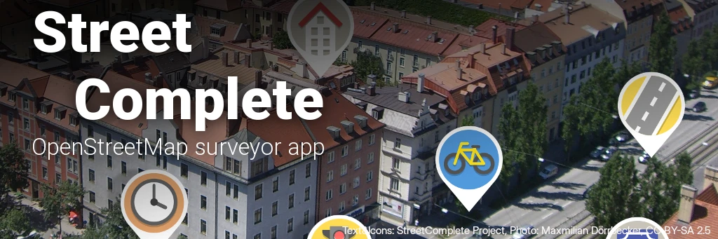
Přispívání do OpenStreetMap: chytání „pokémonů“ se StreetComplete
V dalším díle seriálu o přispívání do OpenStreetMap se věnuji tomu nejméně náročnému způsobu – doplňování informací k již existujícím objektům. Dozvíte se, jak na to ve skvělé aplikaci StreetComplete.
#MapComplete #mapy #OpenStreetMap #OSM #StreetComplete
blog.eischmann.cz/2024/07/24/p…