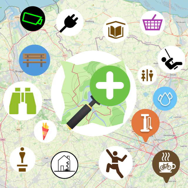
@Bert bei @MapComplete gibt es auch eine Spezialkarte für "Trinkwasserstellen": mapcomplete.org/drinking_water…
Search
Items tagged with: mapcomplete
EDIT: maintenance is done
The #Panoramax instance for #MapComplete might have some downtime tonight as @thibaultmol will be changing some configs and stuff. It might only take 5 minutes. it might also take an hour. Should start around 19:30 Brussels time.
This means that image uploads will temporarily fail, but the images you take should be re-uploaded automatically on your next visit to MapComplete.
A big announcement:
#MapComplete is now available as #Android app on the #Google #Playstore
Grab your copy here: play.google.com/store/apps/det…
(If you don't like google, the Android version is alson available on #FDroid: f-droid.org/en/packages/org.ma…
Or you can use the web version on mapcomplete.org)
MapComplete | F-Droid - Free and Open Source Android App Repository
Thematic, editable maps based on OpenStreetMapf-droid.org
Don't feel like writing #reviews on #Tripadvisor & Co.? With #MapComplete, you can write reviews using @mangroveReviews
Designed to be essentially anonymous unless you are connected to MapComplete with #OpenStreetMaps.
No real account, but Mangrove has a public/private key system to group your reviews with the IP address of each new device/browser.
On MapComplete, editing/deleting is possible, but remember to refresh the page to see the (...) button to do so.
mas.to/@mangroveReviews/111811…
Open Reviews Association (@mangroveReviews@mas.to)
You can also write and read open reviews via a number of local tourism organisation websites: https://open-reviews.net/about/ecosystem/ They make use of our web widget to integrate the functionality easily: https://open-reviews.mas.to
Flemme de rédiger un avis sur #Tripadvisor & Cie ? Avec #MapComplete c'est possible d'en rédiger grâce à #MangroveReviews.
Conçu pour être essentiellement anonyme à moins d'être connecté à @MapComplete avec #OpenStreetMaps.
Pas de véritable compte, mais Mangrove dispose d'un système clé public/privé pour regrouper vos avis avec l'IP de chaque nouvel appareil/navigateur.
Sur MapComplete modifier/supprimer est possible, mais pensez à rafraîchir la page pour voir le bouton (...) pour le faire.
Even on the night before the party, we were agonizing over the perpetual question - what editor to teach to newcomers?
And after the workshop and the latest mapping party, I think I have a new and improved idea.
- We always introduce #CoMaps (and earlier Organic Maps) to newcomers, focusing on it as a means of using OSM. But we avoid using its editor - offline data can be confusing and (in the presence of concurrent editors) can more easily lead to duplication.
But if we want people to recommend CoMaps to other, less technical people…they may want the latter to be able to add places without installing another app.
- I have long admired StreetComplete’s gamified interface, but always figured that it would cause issues in a mapping party.
But perhaps we can incorporate it after all? The people it is most likely to cause issues for are the #Vespucci users, and they are experienced enough (and Vespucci’s tooling is good enough) to handle upload conflicts.
Another issue is that if a user adds some data using a #StreetComplete layer, it takes time for quests to appear for it.
- #MapComplete is good because it puts together the things people coming from Google Maps often expect from OSM - map data, photos, and ratings+reviews. The questions and the photo-taking may also add some variety and fun, and the photos also help other mappers verify the data and add details.
So here’s the new idea -
- We practice adding 1-3 POIs with CoMaps. There may be duplication, but that’s okay, we (the organizers) will clean it up later as we usually do.
- Then, we add 5-10 POIs with MapComplete.
- Finally, we try out StreetComplete to add more details to the streets and POIs. We will use SC’s team mode to divide quests between people on the same team.
I’ll test the viability of this process soon.
(Vespucci will go back to being an editor for regular participants.)
Mal ab davon, dass ich bisher noch nie eine funktionierende #mapcomplete Karte erstellen konnte 🙈 ...
... träume ich noch von der Tourismus Karte. Die, bei der man einfach während dem Sightseeing allerlei Dinge mappen kann ohne die Karte wechseln zu müssen.
Dinge hinzufügen, Daten erweitern, Bilder und Bewertungen hinzufügen ist das Ziel.
1/2
Heute zum #recommendationThursday #empfehlungsDonnerstag
mapcomplete.org/shops.html?z=1…
#mapcomplete macht's möglich 💪
#fulda lasst mal anfangen regionale Läden zu bewerten 🤘🏿
#streetcomplete #MapComplete #osm #openstreetmap
- streetcomplete (70%, 21 votes)
- mapcomplete (3%, 1 vote)
- situationsbedingt (6%, 2 votes)
- hä?!? (20%, 6 votes)
If it is still around, here is a map of old railway gear. Onoy requirement to be added is to be permanently in the same place: mapcomplete.org/historic_rolli…
Historic rolling stock
A map showing all historic, permanently installed rolling stock, such as locomitives and railway carriages, emapcomplete.org
As you might know, we have an #Android app version of #MapComplete in the works, which makes it even easier to see and edit #OpenStreetMap
After a bit of initial testing, we are opening up the test program to our followers here on Mastodon.
If you want to join the beta testers, send an email to info@mapcomplete.org
Any issues? Head over to mapcomplete.org/issues
TIL there’s a “native” #MapComplete in F-Droid! And it utterly blows away the web version and the “installed” PWA in terms of responsiveness… (I tested these with Fennec)
What magic is this, @MapComplete ? 😳
Of course. Even better, everyone with good tagging knowledge and a few hours time can create their own layer at mapcomplete.org/studio
When the layer is finished, let us know (e.g. in the issue tracker) and we might include it in the official #MapComplete
Great! Welcome to the #OpenStreetMap community 🙂
Please note that the #OrganicMaps developer community has forked it under the name @CoMaps due to governance and future takeover concerns. #CoMaps has replaced Organic Maps as my first recommendation for an OSM app.
#OsmAnd has been mentioned as a more powerful alternative to CoMaps/Organic Maps. However, if someone doesn’t need offline maps (maybe they’re low on storage), or maybe you need to share a place on OSM with someone who doesn’t have CoMaps/Organic Maps/OsmAnd installed - check out osmapp.org/ (@osmapp), which is a progressive web app with multilingual vector tiles, navigation, photos from Wikimedia Commons, 3D buildings, indoor maps, and more.
mapcomplete.org/ (@MapComplete) is another web app worth checking out. It works on all devices, the concept of themed maps helps you discover some of the possibilities of OSM, and it has a beginner-friendly quiz-like editor similar to StreetComplete.
Most notably, #MapComplete shows you photos of places (including photos of restaurant menus!) from #Panoramax (@panoramax) , and ratings and reviews from #MangroveReviews (@mangroveReviews) …and it allows you to easily add them yourself using only your OSM account. Panoramax and Mangrove Reviews are libre (“open”) data projects just like OSM, and can help all OSM apps.
I’ve heard that Magic Earth (proprietary) uses OSM data and has traffic information too. Worth a look?
MapComplete - editable, thematic maps with OpenStreetMap
MapComplete is a platform to visualize OpenStreetMap on a specific topic and to easily contribute data back to it.mapcomplete.org
Mapcomplete.org ist getting better and better.
A few days ago I discovered that its possible to add manmade bird nests. I was standing near a stork's nest when I found the topic. And directly added a picture.
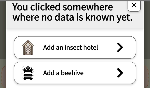
I also found by chance that beehives can be added. And that there are also viewpoints to add under the theme of nature.
It would be nice if there was some information and not find by chance.
something new thats still hidden under some Theme?
#MapComplete can now be downloaded as #Android #app from the official #Fdroid-repositoried!
Download via f-droid.org/packages/org.mapco…
This is a packaged version of the webversion, so features will remain the same between visiting the website and the app. Using the app has the advantage that all assets are already on your device, requiring less network.
MapComplete | F-Droid - Free and Open Source Android App Repository
Thematic, editable maps based on OpenStreetMapf-droid.org
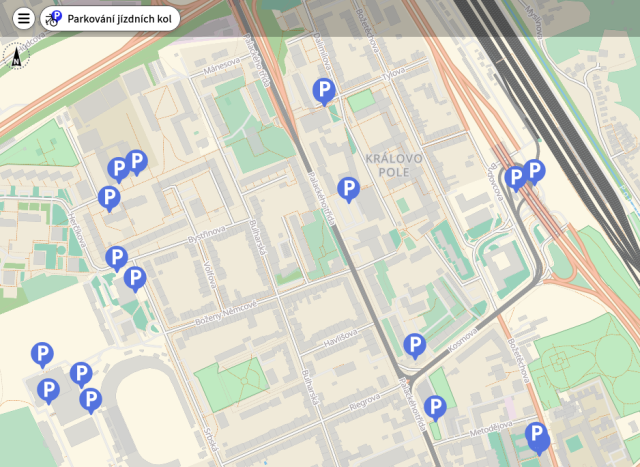
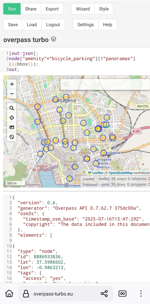
I am uploading pictures (#PanoramaX), as well of other details, in the bicycle parking theme of #MapComplete. I like to take the pictures and upload several afterwards.As sometimes I didn't remember whether a bicycle parking has already pictures or not I find useful this simple overpass(overpass-turbo.eu/)that shows you which ones in an area lack them.
I share it JIC anybody find it useful:
[out:json];
node["amenity"="bicycle_parking"][!"panoramax"]({{bbox}});
out;
#OpenStreetMap
overpass turbo
A web based data mining tool for OpenStreetMap which runs any kind of Overpass API query and shows the results on an interactive map.overpass-turbo.eu
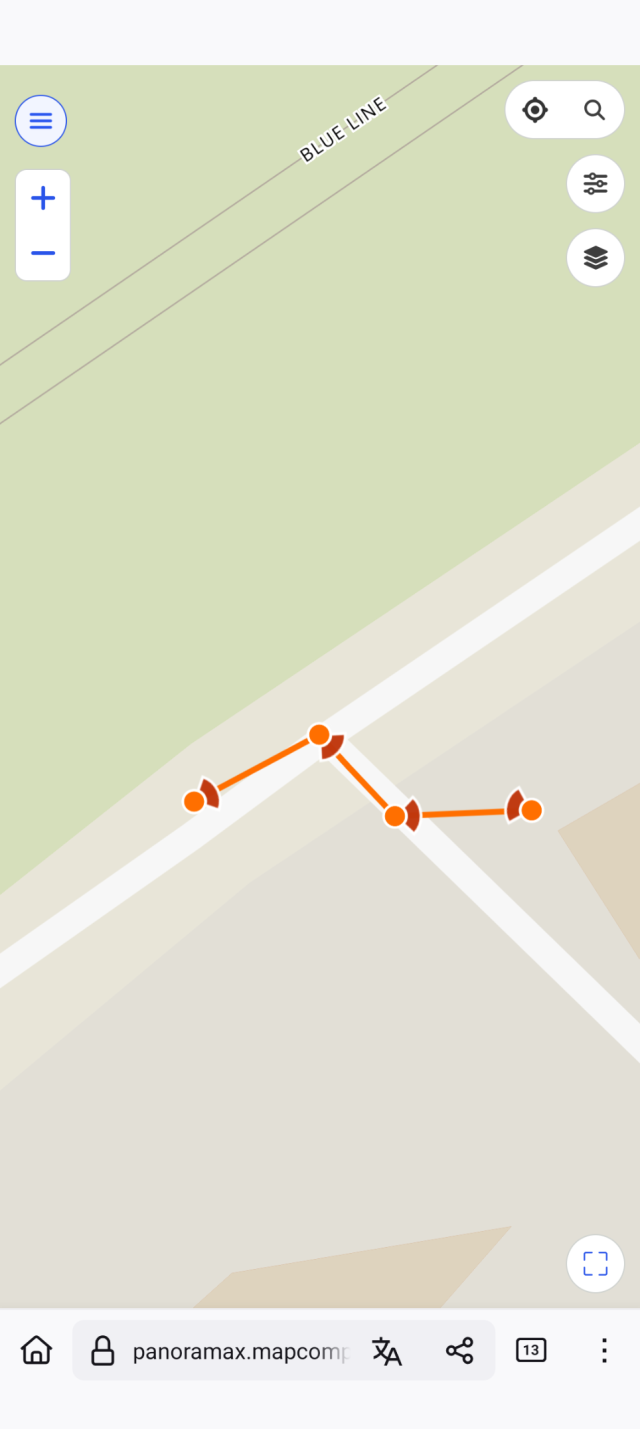
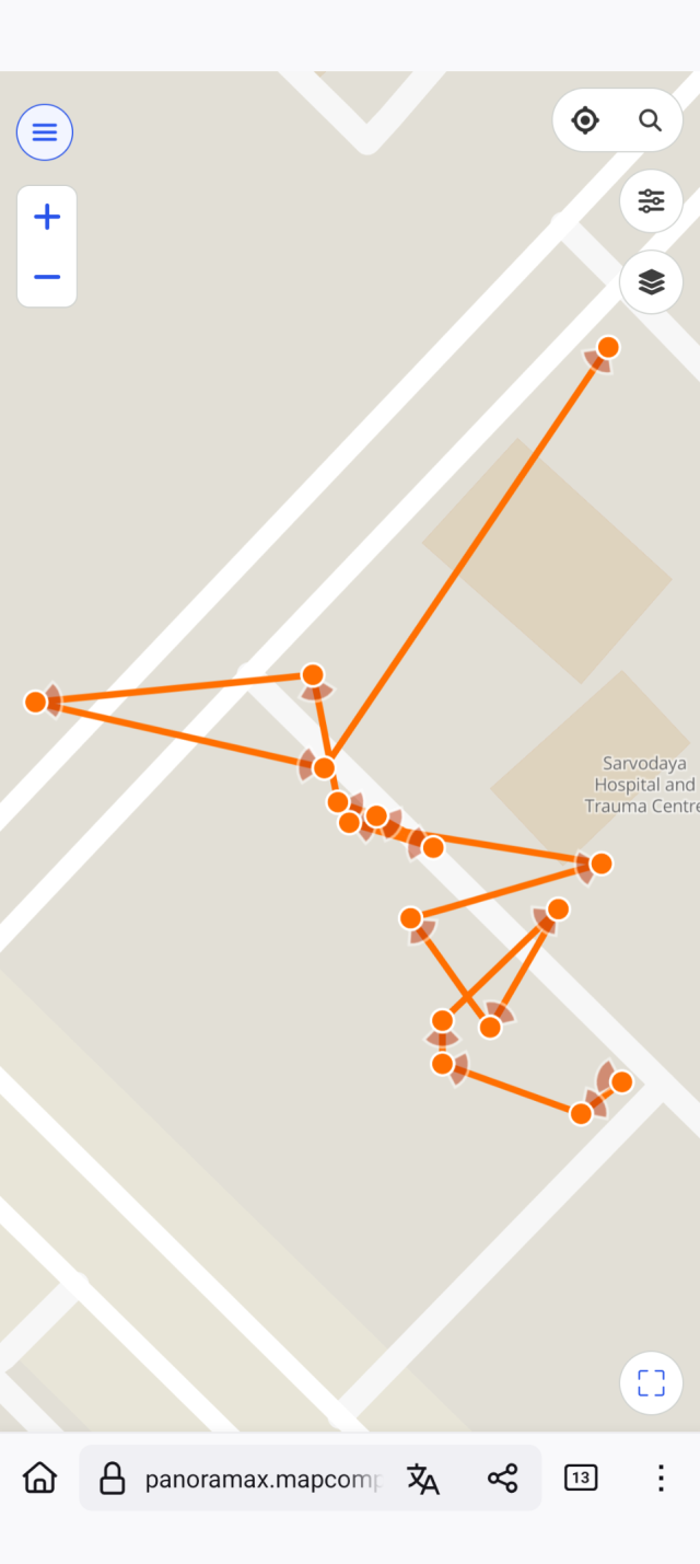
For sake of trying something new, we introduced #MapComplete ( @MapComplete ) as the first editor for our 6 new mappers. While there were some rough edges, it enabled them to contribute photos to #Panoramax.
panoramax.mapcomplete.org/?foc…
#OpenStreetMap #OSM #Delhi #India #OSMNCR
Been adding restaurant ratings and reviews to Mangrove Reviews @mangroveReviews using MapComplete @MapComplete
I’ve written 6 so far, and there’s more to come! Plenty of WIP drafts to finish 🙂
This really plays to my strengths, combining my love for
- writing,
- improving OpenStreetMap, free data, and freedom-respecting software,
- reviewing (as a child, I liked to review the theatre I watched with my parents…my parents and their theatre friends would often ask me for my review after the show, and would listen to me intently 🥺)
- …and trying new things to eat and drink!
If you like my open data reviews and photos, please support me on Liberapay! I need to be able to afford eating out to continue reviewing 😅
PS MapComplete currently removes all line breaks from the reviews it displays (which breaks things like paragraphs and bullet lists), and Mangrove Reviews truncates the text of the reviews it displays. So there’s no perfect way to view the reviews right now…I’ve let the developers know about these issues and they will hopefully fix them soon.
#MangroveReviews #MapComplete #OpenStreetMap #OSM #FreeSoftware #Libre #FreedomRespecting #OpenData #LibreData #India #Delhi
contrapunctus's profile - Liberapay
OpenStreetMap I'm a prolific OpenStreetMap contributor. I work in Delhi for most part, and additionally wherever I might happen to travel.Liberapay
MapComplete - editable, thematic maps with OpenStreetMap
MapComplete is a platform to visualize OpenStreetMap on a specific topic and to easily contribute data back to it.mapcomplete.org
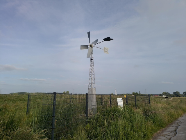
I encountered a really nice and relaxing to see (and hear) #windpump today...
As a result, mapcomplete.org/openwindpowerm… on #MapComplete will have "windpumps" as a category soon too!
@contrapunctus @eliasp @mangroveReviews @MapComplete @lib_reviews
#mapcomplete seems to be very easy to use. Mapy.com looks of course a lot better, but I like the spirit of having libre data. Let's hope someone is motivated enough in the future to polish the web UI.
Thanks for the hints 🤗
It took almost 9.5 years to make 20,000 edits with OsmAnd for OpenStreetMap. Thanks to Quick Action it has recently become easier and faster. But since the introduction of Streetcomplete and especially Mapcomplete, I've been mapping a little less with OsmAnd lately. Let's see how long I need for the next 10,000.
#OSM #OpenStreetMap #Osmand #MapComplete #streetcomplete #mapping #maps
This is a nice point of view! ✌️
#streetcomplete is indeed a great way. // @streetcomplete
#MapComplete has no app but it also runs like a charm if you make a starter with your browser app // @MapComplete
Both have different approaches and are very active developed. So, start mapping for #osm 🙂
Summer 24 somewhere in Sweden.
After a delicious dinner, we went for a digestive walk with the midnightsun and making some survey. Of course I used the Osmand app with Quick Action function, Streetcomplete and took pictures with Mapcomplete.
#mapping #sweden #osm #OpenStreetMap #osmandapp #streetcomplete #MapComplete
When I started mapping the first additions in the OsmaAnd app for Openstreetmap at the end of 2015, I never thought I would make 1 million changes. Entered in OsmAnd and then in Potlach2 (because it was beginner-friendly). Then later iD and other apps. Like Mapcomplete, Streetcomplete or Everydoor. 1
I can only recommend just getting started.
#osm #OpenStreetMap #osmand #MapComplete #streetcomplete #EveryDoor #Karten #Landkarte #map #opensource
Chcete si na mapě zobrazit všechny výskyty nějakého objektu (knihobudky, bankomaty, pítka, veřejná ohniště...)? Snadno to jde například s @MapComplete (mapcomplete.org/). Chybějící objekty můžete i doplňovat, podobně jako přes @streetcomplete.
#mapa #OSM #MapComplete #StreetComplete
MapComplete - editable, thematic maps with OpenStreetMap
MapComplete is a platform to visualize OpenStreetMap on a specific topic and to easily contribute data back to it.mapcomplete.org
@MapComplete Hey ! First time I'm coming on the website mapcomplete.org, and quickly trying the webinterface.
I've clicked on the "Sports" tab, and was sad to not see some "disc golf courses" on this menu.
wiki.openstreetmap.org/wiki/Ke…
May be useful for people ? 🥏 😉
Looking for vegan places and not a fan of proprietary datasets? #MapComplete has several themes to find (and edit) vegan places, based on #OpenStreetMap data!
The “restaurants and fast food” theme will show most places you might be interested in. If you love fries (like I do), “fries shops” will be helpful for you. And in the “gluten free” and “lactose free” themes, you can filter for vegan places too!
You can also easily edit these places with MapComplete, for example to add details or update incorrect or outdated information. Your changes will be uploaded to OpenStreetMap, which is freely reusable data!
MapComplete - editable, thematic maps with OpenStreetMap
MapComplete is a platform to visualize OpenStreetMap on a specific topic and to easily contribute data back to it.mapcomplete.org
We will disable the translations on hosted.weblate in a few weeks and remove the project there as well; once most activity has moved to our instance.
We'd like to thank @weblate for providing the software and for hosting us this long; and of course all the translators who helped to make #MapComplete available in their language! This would not have been possible without all your help.
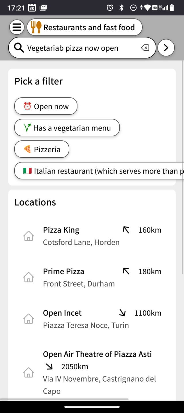
You might have noticed already: since a few weeks, #MapComplete has a totally new search experience.
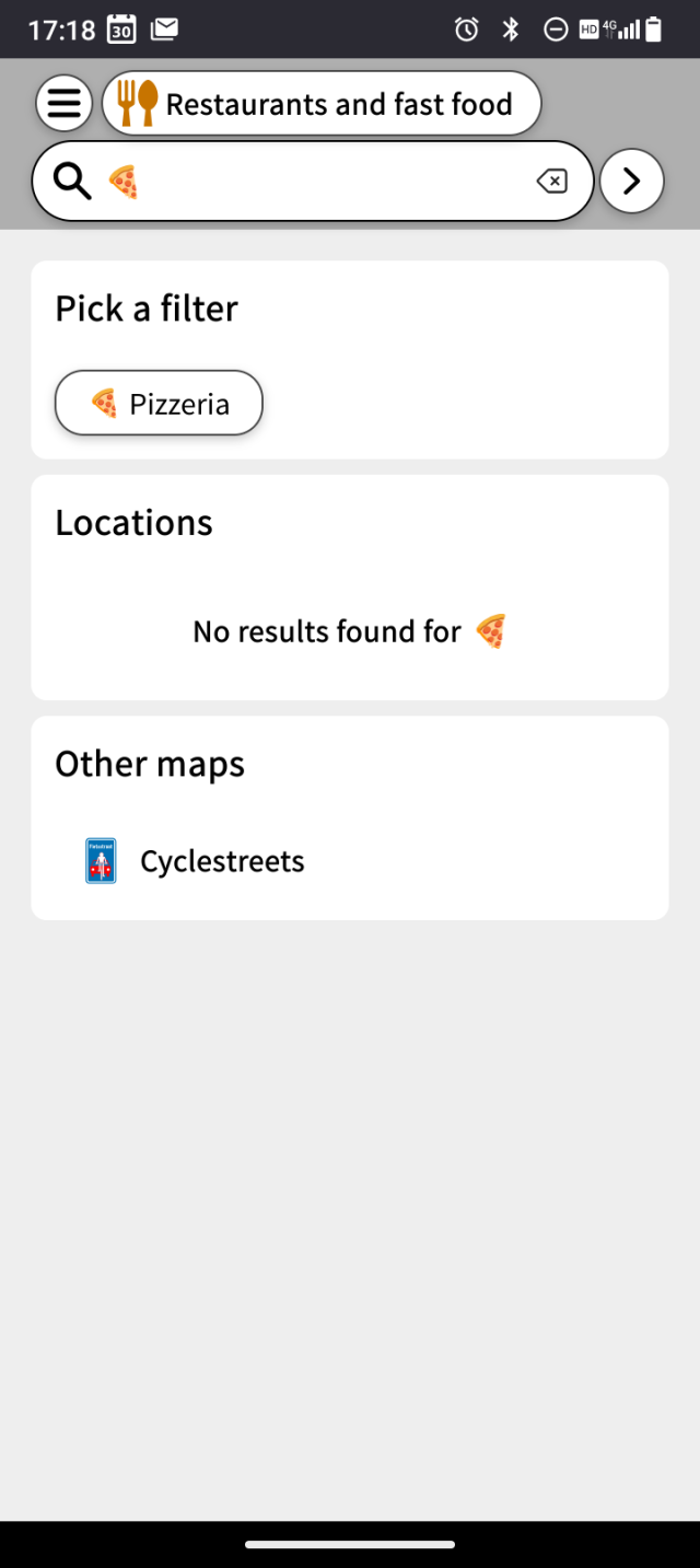
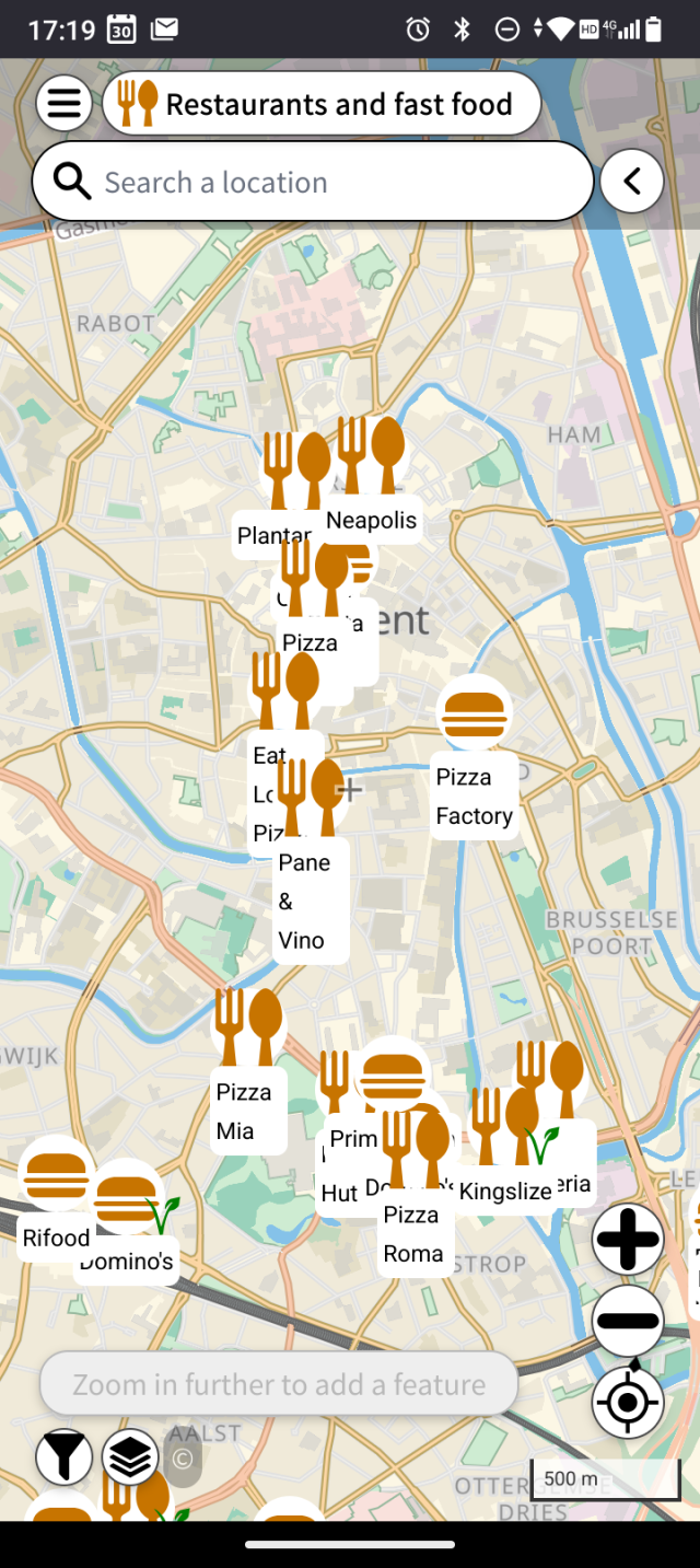
If you search something, the matching locations are shown on the map. If it matches the name of a layer or a filter, you can also opt to show only this layer or to enable this filter. For examplr, on mapcomplete.org/food, one could search for 'sushi' to only see sushi restaurants and then for 'open now'. Or search with an emoji, such as 🍕🍟🥙 or 🍙
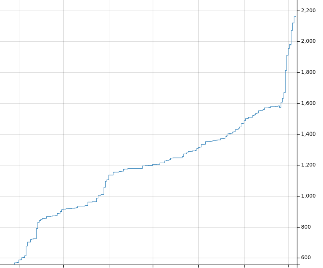
Guess when #MapComplete started uploading pictures to our @panoramax -instance and started introducing `panoramax`-tags to the #OpenStreetMap-database...
There are 614 pictures in our instance for now.
If you want to see the graph for yourself, it is here: taghistory.raifer.tech/?#***/p…