#OpenStreetMap just crossed 150 million changesets 🥳
openstreetmap.org/changeset/15…
Changeset: 150000000 | OpenStreetMap
OpenStreetMap is a map of the world, created by people like you and free to use under an open license.OpenStreetMap
#OpenStreetMap just crossed 150 million changesets 🥳
openstreetmap.org/changeset/15…
OpenStreetMap is a map of the world, created by people like you and free to use under an open license.OpenStreetMap
I am working a talk for DORS/CLUC in Zagreb about #OSM.
My topic is how and why to start contributing to #OpenStreetMap as a total beginner. I'll be showcasing tools such as @streetcomplete , @everydoor, @MapComplete.
I'll be also talking about #gamification, #community, helping projects like #hotOSM and #OpenHistoryMap.
Do you have any tricks or ideas you would like me to include into the talk. How would you encourage a total stranger to start contributing?
Dani otvoreni računalnih sustava / Croatian Linux users' conferenceDORS/CLUC
🗺️ 𝘖𝘱𝘦𝘯𝘚𝘵𝘳𝘦𝘦𝘵𝘔𝘢𝘱 3𝘋 🧊
Zoom in to street level to see the 3D features.
#map #maps #OpenStreetMap #3D #topography #world #WorldMap #cities #landscape #environment #data #tools #OpenSource #FOSS
F4 Map is a WebGL 3D Map Viewer based on OpenStreetMap dataF4map Demo - Interactive 3D map
Herinnering: volgende week is er #OpenStreetMap -meetup in #Gent: osmcal.org/event/2710/
Iedereen (met interesse in OpenStreetMap) is welkom!
(English below) Een gezellig samenkomen voor iedereen die interesse heeft in OpenStreetMap en digitale kaarten - van totale beginner tot expert.OpenStreetMap Calendar
I finally got around to fixing bikehero.io
Use it to find and add bicycle repair stations to @openstreetmap
Basemap now powered by @protomaps
Hello peuple d'#OSM, si y'a des gens partants pour faire un projet du mois sur les écoles on peut faire ça, on était deux ou trois motivés pour avancer sur ce sujet ici:
forum.openstreetmap.fr/t/proje…
#openstreetmap #écoles #teamProf #cartographie #mapping
ok y’a des choses à réfléchir sur school:FR, ce serait bien de ne proposer que des tags où on est bons sur la désignation.Forum OSM France
Op 29 maart is er een #OpenStreetMap #meetup in #gent
Idereen met interesse in digitale #kaarten, #cartografie #gps-applicaties (zoals bv. #Komoot, #RouteYou, #OsmAnd, ...) is welkom om meer te weten te komen over dit #OpenSource platform.
Alle info op mobilizon.openstreetmap.fr/eve…
(English below) Een gezellig samenkomen voor iedereen die interesse heeft in OpenStreetMap en digitale kaarten - van totale beginner tot expert.mobilizon.openstreetmap.fr
@float13 Hehe, kind off, except that the machine was powered of.
However, it is one of the few times that #OpenStreetMap was used for data routing ;)
Menstrual products can now be tagged in #OpenStreetMap 🎉
The vote went through and the proposal was accepted! If you encounter a toilet that has menstrual products available (or if you want to document the lack thereof) you can now use
toilets:menstrual_products=yes/now/limited
PS: In theory this was possible before but the approved proposal is a way of the community to find a consensus on how to tag. The new tag is now documented and can be included in survey tools like #StreetComplete
For all the lonely souls out there who celebrated #valentines day alone yesterday: mapcomplete.org/openlovemap
(This theme is 18+)
For reference: we saw that openlovemap.de was very broken. I can't stand broken #OpenStreetMap stuff, so I rebuilt it on MapComplete.)
mapcomplete.orgLove in the palm of your hand
Open Love Map lists various adult entries, such as brothels, erotic stores and stripclubs
A new thematic #map arrived: mapcomplete.org/ski
It features an interactive display of:
- #ski pistes
- #aerialways
- 3D-visualisation of the terrain
- various useful POI, such as #guideposts, information boards, #restaurants mountain #rescue stations, ...
All data is of course based on #OpenStreetMap (with the addition of height data and aerial imagery of course)
This might or might not be created because @pietervdvn went #skiing last week ;)
Yesterday, I reached the point of 1,000,000 map changes and 20,000 changesets on #OpenStreetMap. It made me pause for a second and I wrote down a few thoughts in a diary entry entitled "What is OpenStreetMap, really?": openstreetmap.org/user/L'imagi…
Looking forward to hearing your comments on it!
Keep on mapping!
OpenStreetMap is a map of the world, created by people like you and free to use under an open license.OpenStreetMap
Rebuilding FourSquare for ActivityPub using OpenStreetMap
shkspr.mobi/blog/2024/01/rebui…
I used to like the original FourSquare. The "mayor" stuff was a bit silly, and my friends never left that many reviews, but I loved being able to signal to my friends "I am at this cool museum" or "We're at this pub if you want to meet" or "Spending the day at the park".
So, is there a way to recreate that early Web 2.0 experience with open data and ActivityPub? Let's find out!
This quest is divided into two parts.
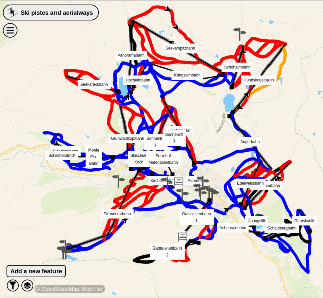
OpenStreetMap is the Wikipedia of maps. It is a freely available resource which anyone can edit (if they're skilled enough).
It also comes with a pretty decent API for querying things. For example, nw["amenity"]({{bbox}});
finds all "amenities" near a specific location.
As you can see, it has highlighted some useful areas - a pharmacy and a pub. But it has ignored other useful locations - the train station and the park. It has also included some things that we may not want - bike parking and a taxi rank.
What API call is needed to get useful locations of of OverPass?
It's possible to specify the type of thing to find using nw["amenity"="restaurant"];
- but adding every single type of thing would quickly end up with a very large query containing hundreds of types.
It is also possible to exclude specific types of places. This retrieves all amenities except for fast food joints:
nw["amenity"]({{bbox}});-nw["amenity"="fast_food"]({{bbox}});
Perhaps one solution is just to return everything and let the user decide if they want to check in to a telephone kiosk or a fire hydrant? That's a bit user-hostile.
Instead, this query returns everything which has a name nw["name"]({{bbox}});
That cuts out any unnamed things - like park benches and car-sharing spots. But it does add named roads and train lines.
It is possible to use filters to exclude results from OverPass. The best that I can come up with is: nw["name"][!"highway"][!"railway"][!"waterway"][!"power"]({{bbox}});
That gets everything which has a name, but isn't a highway or railway or waterway or powerline. It isn't perfect - but it will do!
This is the query which will retrieve the 25 nearest things within 100 metres of a specific latitude and longitude. It includes the name and any other tags, the location, and the OSM ID.
There's good news and bad news here. Firstly, ActivityStreams (which are subscribed to in ActivityPub) supports the concept of "Place" and "Location".
Once the user has a latitude and longitude, the can share it - along with a message, photo, or anything else.
Something like:
{ "@context": "https://www.w3.org/ns/activitystreams", "type": "Note", "content": "Here in NYC! <a href=\"https://www.openstreetmap.org/way/958999496\">John Lennon's Imagine Mosaic</a>.", "attachment": [ { "type": "Image", "mediaType": "image\/jpeg", "url": "https:\/\/fastly.4sqi.net\/img\/general\/590x786\/56367_9pxuZJD7d1hgPdaMFcFq1pipvTTMynBJsYcpHH-b8mU.jpg", "name": "A photo of a mosaic which says 'Imagine'." } ], "location": { "name": "John Lennon's Imagine", "type": "Place", "longitude": 40.77563, "latitude": -73.97474 }}
It is worth noting that Mastodon doesn't (natively) support location - if you view my repost of that PixelFed post you'll see there's no location metadata attached. That's OK! It just means that the status needs to include human-readable data.
Similarly, Mastodon doesn't support the arrive
vocabulary. So this will be limited to a message with a location attached.
Other ActivityPub services do support location.
Well… that's a job for next week. Probably!
If you'd like to help, please leave a comment.
shkspr.mobi/blog/2024/01/rebui…
#ActivityPub #fediverse #FOURSQUARE #geolocation #OpenStreetMap
A basic tutorial covering the key features of the Overpass languageosm-queries.ldodds.com
A ghost bike is a memorial for a cyclist who died in a traffic accident, in the form of a white bicycle placed permanently near the accident locationmapcomplete.org
If you want to participate in #OpenStreetMap in a simple way, I recommend taking a look at #StreetComplete
With the news that Google is going to "supercharge" Maps with "AI" (and the poor results I've had with Apple Maps), I finally checked out OpenStreetMap: openstreetmap.org/
OMG THIS IS AMAZING. So much more useful detail! Incredible! Going to dig up an app for my phone and use this for a while to see how it compares to the ad- and AI-ridden nonsense.
OpenStreetMap is a map of the world, created by people like you and free to use under an open license.OpenStreetMap
An #OpenStreetMap contributor wrote 📝 about, "Welcome to the newest (and returning) OSMF Local Chapter: OSM Belgium."
Read 👁️🗨️ it in @openstreetmap 👉🏼 openstreetmap.org/user/arnalie….
OpenStreetMap is a map of the world, created by people like you and free to use under an open license.OpenStreetMap
Do you use the OSM API directly? Make an OSM App? We're dropping support for certain insecure, legacy authentication methods. If you're using them in your app, it risks breaking! _(If this is gibberish to you, you're probably not affected)_
OSM API will remove support for HTTP Basic Auth, & OAuth 1.0a. You'll have to migrate to the modern OAuth 2.0 feature, which is very well supported.
read more: community.openstreetmap.org/t/…
#OpenStreetMap #OSM
cc: @osm_tech@osm.town
The Operations Working Group is shutting down OAuth 1.0a and HTTP Basic Auth in 2024. They have been deprecated since 2023 and their role in authorization has replaced by OAuth 2.0 which the standard authorization method for most systems.OpenStreetMap Community Forum
📝 An #OpenStreetMap contributor posted a diary entry, "MapComplete: 2023 in review."
Read all about it 👉🏼 openstreetmap.org/user/Pieter%….
OpenStreetMap is a map of the world, created by people like you and free to use under an open license.OpenStreetMap
Heb je interesse in #OpenStreetMap en woon je in #Gent of in de buurt?
Nu donderdag (18 januari) is er een OSM-community meetup met gratis #pizza in de kantoren van TomTom. Meer informatie hier: meetup.com/openstreetmap-belgi…
Op maandag 22 januari is er dan weer een introductie in 't Assez. Hier beginnen we vanaf nul, dus ideaal als je interesse hebt in Geo, FOSS of gewoon een goeie app zoekt maar nog nooit iets met OpenStreetMap hebt gedaan: mobilizon.openstreetmap.fr/eve…
TomTom's OSM team welcomes anyone interested in OpenStreetMap to the TomTom office in Gent for food, drinks and good company. We will kick the night off wiMeetup
📝 An #OpenStreetMap contributor wrote an entry: landuse=forestry.
Read more here: openstreetmap.org/user/Zkir/di…
OpenStreetMap is a map of the world, created by people like you and free to use under an open license.OpenStreetMap
#EveryDoor verfügbar auf @fdroidorg : f-droid.org/de/packages/info.z…
"This editor does not make you think. Just go to a mall, and start Every Door. You'll see mapped #shops around you: tap on the checkmark for any that are still there, and add shops that are not on the map. That's the entire process: you can keep your entire town up-to-date thanks to this simple editor."
Mobile OpenStreetMap editor for POI & micromappingf-droid.org