
Trying out the #MapToPoster script by Ankur Gupta on cities in #Denmark. Thank you for the tip @alan
#OpenStreetMap #Aarhus #Aalborg #Copenhagen #Odense


Trying out the #MapToPoster script by Ankur Gupta on cities in #Denmark. Thank you for the tip @alan
#OpenStreetMap #Aarhus #Aalborg #Copenhagen #Odense
I published my slides for the #FOSDEM lightning talk in the #geospatial room:
> Lessons from teaching 100+ beginners to use the OpenStreetMap <
Do you have the same challenges as I do?
Well done @MapComplete for resolving a bug in less than a day! ⚡ thanks from Italians 🍕
P.S. Forgejo is so nice! Lovely integration with OpenStreetMap OAuth. Really simpler than GitHub and GitLab! 👏
source.mapcomplete.org/MapComp…
#OpenStreetMap #MapComplete #Forgejo

I noticed that, when an Italian street is called "Viale XYZ" (example: "Viale Marebello"), then the prefix "**Viale**" is not omitted correctly. The "le" part remains by mistake.Forgejo
Everyone knows Streetcomplete, but have you heard of MapComplete yet?
What a nice project, i recently found. Contribute to Open Street Map theme and project based.
mapcomplete.org/ by @MapComplete
#MapComplete #OSM #openstreetmap

MapComplete is a platform to visualize OpenStreetMap on a specific topic and to easily contribute data back to it.mapcomplete.org

11/12/2025-17/12/2025 [1] Interactive Map Dashboard to monitor current disaster mitigation efforts for the recent Sumatra floods and landslides.| © Tilikan Indonesia | map data © by OpenStre…weekly - semanario - hebdo - 週刊 - týdeník - Wochennotiz - 주간 - tygodnik
Still exploring OpenStreetMap data with this map of sundials in Europe.
#openstreetmap
There are in fact many more sundials. If you know one around you, please mark it on on openstreetmap.org/
Well... is it a map of sundials or a map of OSM contributors?🤔 Anyway, congratulations to northern Italy!
#astronomy #maps
#Python script available on my blog.

OpenStreetMap is a map of the world, created by people like you and free to use under an open license.OpenStreetMap
Mira mamá... Salgo en @MapComplete
Y aprovecho para decir que lo que me encanta de esa app es que te guía con preguntas a la hora de rellenar la información del sitio que estás creando o actualizando.
via @mapcomplete_edits
en.osm.town/@mapcomplete_edits…
")
Attached: 4 images 10 contributors uploaded 65 images. Images in this thread are randomly selected from them and were made by: Awo @mnalis@mastodon.online Thomal84 Đuro Jiří ntzm @plicploc@pixelfed.social sparky100 @Edent@mastodon.Edits made with MapComplete (OSM Town | Mapstodon for OpenStreetMap)
We've released V21.2, as our 'traditional' end-of-year release.
There are some minor changes relative to the beta, most notably the addition of a warning if you are moving a way that has a majority of its nodes off screen, the minimum number of nodes for the check to be active can be set and the default is 5.
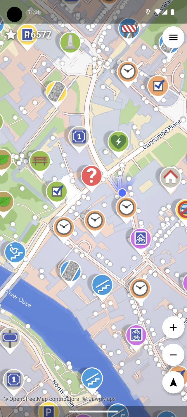
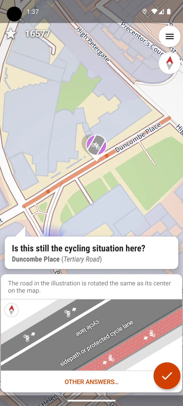
Oooohhhh... First of all, road works and similar are somewhat temporary, something that #OpenStreetMap generally doesn't map. Or rather, there is no consensus on what duration road works should take before we do map them.
In any case, feel free to open an issue or even a pull request here: source.mapcomplete.org/mapcomp…

MapComplete is a webapp which allows to use and update OpenStreetMap within thematic maps. This repository contains all of the source code.Forgejo
🆕 blog! “OpenBenches 💖 OpenStreetMap”
When Liz and I created the OpenBenches website, it was just designed to be a fun way for people to record memorial benches. Since then things have got out of hand and we now have over thirty-nine thousand benches recorded!
Our plan was never to compete with something like OpenStreetMap. The OSM project is vast, complex, and…
👀 Read more: shkspr.mobi/blog/2025/11/openb…
⸻
#OpenBenches #OpenStreetMap
https://shkspr.mobi/blog/2025/11/openbenches-%f0%9f%92%96-openstreetmap/
Last year the Geospatial devroom only had half a day at FOSDEM, and we still ended up with a packed room and a queue down the corridor.
This year we have the whole of Saturday to ourselves, so if you have something geo-flavoured to share, whether it is maps, data, tools, clever hacks, fieldwork tech, city projects, OSM magic, climate work or anything else, now is the moment to submit a proposal.
The CfP is open until 1 December:
lists.fosdem.org/pipermail/fos…
#FOSDEM #Geospatial #GIS #OpenStreetMap #OpenData #Cartography #GeoTech #OSM #FOSS4G #Maps #Devroom #OSGeo

Lastly @trigpoint mapped most of the benches we saw.
A plea to all #OpenStreetMap folk: please map benches. Knowing where they are can help people like me with COPD and other breathing conditions. Benches make all the difference as to whether a walk is pleasant or not, and sometimes whether one is possible at all.
I find hat still being able to walk 8-9 km walk sustain nmy mental health. Any infrastructure which helps is invaluable.
10/10
@ultrazool @zverik @millerdl @gregorymarler


StreetComplete is a really fun and accessible way to contribute to OpenStreetMap from an Android device - walk around in your local neighbourhood (or anywhere really) and solve 'quests' by answering questions about the things around you!
You don't need to learn anything about mapping conventions, or infrastructure, or about the more complex mapping tools that exist for OpenStreetMap. The app will explain everything to you that you need to know, when you need to know it, and ask easily understandable questions with reference pictures for the answers.
The only setup needed is to make an OSM account and log into it from the app, so that it can upload your answers - and you can also do that at any later time, after trying out the app without an account for a while first. You can just install it and go outside right away!
The app doesn't need any cellular internet connection; it can work offline and synchronize your answers once you reach a place with eg. WiFi. It's also quite performant, and should run well even on lower-end phones. There is also a 'multiplayer' option that lets you split up in teams and each tackle different quests in the area.
#StreetComplete #OpenStreetMap
alors dans le même genre tu as aussi #mapcomplete mapcomplete.org/ qui permet de voir, modifier ou ajouter facilement un type de données en particulier.
Ils ont aussi une app mobile : app.mapcomplete.org/
Et aussi un compte ici : @MapComplete

MapComplete is a platform to visualize OpenStreetMap on a specific topic and to easily contribute data back to it.mapcomplete.org

Collecting OpenStreetMap-compliant accessibility data in public transportplay.google.com
Very sad news: OpenTopomap is being retired, basically.
opentopomap.org/about#survival
Many thanks to the people who gave their time over 14 years so that we could use this wonderful gift.
#OSM
#OpenStreetmap
#OpenTopomap
Supplement:
In his message the main developer (?) of Openstreetmap mentions that there may be a successor.
If you think you are able to: Get in touch with him and ask if and how you can help.
Ich möchte eine Empfehlung aussprechen. Ich habe mit StreetComplete eine App gefunden, mit der man auf einfache und spielerische Art und Weise zu @openstreetmap beitragen kann. Die App zeigt dir um deinen Standort herum an, wo noch Daten fehlen und mit der Beantwortung von einfachen Fragen kannst du helfen, die Kartendaten zu vervollständigen. Sehr cool! Und total easy.
f-droid.org/de/packages/de.wes…
#openstreetmap #StreetComplete

Unterwegs kartieren für OpenStreetMapf-droid.org
Tak zítra na @openalt GIS a #openstreetmap sekce, bohužel paralelně 3 přednášky spolu.
Snad se s vámi uvidím v 🦆 na @maptiler.bsky.social mapách!
That small joy when you unexpectedly come across a public bookcase that isn’t yet mapped in #OpenStreetMap .It's like a tiny treasure hunt for mappers 📚🗺️
With a few taps in an app, it’s now part of the OpenStreetMap database. The free global map of public bookcases just got a little bit better.
#OSM #PublicBookcase #Mapping #OpenData #Books


Event Time Announcer shows time for OSM.org Maintenance - Read-only - 3 hour window in locations all over the world. In London it happens on neděle 5. říjen 2025, 10:00:00.www.timeanddate.com
From now on, translate.mapcomplete.org supports logging in with #OpenStreetMap (with the source code repository as intermediate step).
This means one less account to manage!
Thanks to all the translators for providing translations. And of course, feel free to join the #translation effort to get #MapComplete into your language.
Ergänzung:
Bei Hutmacher / #Utopiastadt #Wuppertal steht auch ein Bücherschrank.
Bei @MapComplete gibt es auch eine Karte für Bücherschränke, über die fehlende Schränke leicht ergänzt werden können.
Damit werden die #OpenStreetMap -Daten ergänzt, so dass die Orte dann auch auf Open Book Case und allen weiteren Karten, die auf #OSM basieren dazu kommen.
mapcomplete.org/bookcases.html…

A public bookcase is a small streetside cabinet, box, old phone booth or some other objects where books are storedmapcomplete.org
Blog post about some of the new stuff for GNOME Maps 49.
ml4711.blogspot.com/2025/09/ma…
#gnome #maps #gnomemaps #libshumate #mapstodon #openstreetmap

As time is approaching the release of GNOME 49, I thought I should probably put together a small recap post covering some of the new...ml4711.blogspot.com

A ghost bike is a memorial for a cyclist who died in a traffic accident, in the form of a white bicycle placed permanently near the accident locationmapcomplete.org
TIL that #Mapycom is more than just a renderer on top of #OpenStreetMap. They actually import buildings from #Overture, which #OSM doesn't consider reliable enough for automatic imports.
From what I've seen, the results are mixed in Greece, with many buildings that don't exist in reality.


